
Satellite and Flyover Measurements Gain Attention: A New Perspective on Methane Emission Monitoring at Landfills
By 2023, at least 10 satellites operated by non-governmental organizations will orbit the Earth to capture methane leaking from landfills. These devices are designed to directly measure emissions rather than rely on model estimates. Although current regulations limit their use, growing investment and corporate attention may drive remote sensing assessments to play a greater role in emission tracking.
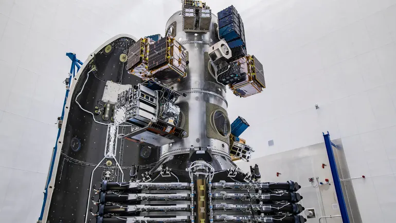
By 2023, at least 10 satellites operated by non-governmental organizations will orbit Earth, photographing methane leaking from landfills—a potent greenhouse gas. Several of these devices have already been launched, representing the first realization of a long-held aspiration in the waste industry: directly measuring landfill emissions rather than relying on model estimates. The timing is apt, as efforts to mitigate climate change increasingly focus on reducing methane as a key way to rapidly address the crisis.
Currently, regulations requiring specific reports to use other estimation models limit the technology's application. It primarily serves as a backup verification tool for facilities, or is used to collect methane emission data in informal sustainability reports. However, increased investment in the technology and corporate attention could allow remote sensing assessments to play a larger role in how facilities track their climate change contributions—provided regulators, scientists, and companies can agree on how each flyover is conducted and interpreted.

Methane Takes Center Stage
In recent discussions about curbing global warming, methane has gained more attention than carbon dioxide. The latest report from the Intergovernmental Panel on Climate Change (IPCC) for the first time lists methane reduction as a powerful option for both short-term and long-term climate change control. Although methane decays rapidly in the atmosphere after about a decade, its warming potency is roughly 80 times that of carbon dioxide during its first 20 years. Cutting methane emissions is seen as one of the best strategies to slow warming most quickly.
Shortly after the IPCC report, the European Union and the United States announced a plan where countries committed to reducing methane emissions by 30% by 2030. According to President Joe Biden at the UN Climate Change Conference (COP26) earlier this week, about 100 countries have signed onto the pledge. Although the Biden administration's climate strategy focuses more on controlling methane from oil and gas operations, it has also prioritized landfills and took steps earlier this year to regulate waste-related methane. Signatories also agreed to "transition to using best available inventory methods to quantify methane emissions"—a process closely tied to the solid waste industry.
The U.S. Environmental Protection Agency (EPA) estimates that municipal solid waste landfills are the third-largest human-made source of methane emissions in the United States. Consequently, federal and state laws require hundreds of individual facilities to report greenhouse gas emissions annually. Most operators follow a protocol known as the "first-order decay model," which estimates emissions based on factors such as waste types and cover layers at the landfill.
Although EPA officials and some independent researchers say these assessment methods significantly underestimate landfill emissions, many facility operators disagree. Direct measurement, landfill operators argue, could resolve this discrepancy.
"We are interested in pursuing more accurate measurement systems and believe our landfill emissions are lower than what current methods report," Tara Hemmer, senior vice president and chief sustainability officer at Waste Management, said in a statement.
The company has participated in research projects directly measuring landfill emissions since at least 2007. In 2019, it launched a project to study airborne and satellite-mounted methane detection equipment. Waste Management plans to "develop more accurate methods for determining landfill emissions" by 2025.
Before Waste Management announced its aerial measurement plans, NASA's Jet Propulsion Laboratory (JPL) had already collaborated with the California Air Resources Board (CARB) and multiple academic institutions to conduct flyover methane assessments in California from 2016 to 2018. Although Waste Management and other landfill operators argue that traditional calculations overestimate emissions, the JPL-led research found otherwise. The project concluded that 41% of the state's largest methane point sources came from landfills, with emission levels higher than CARB's first-order decay model estimates.
The JPL-led detection efforts have expanded internationally, and other non-governmental organizations developing remote sensing methane technologies are also creating or planning other global mapping projects. Some organizations are reluctant to disclose how assessments will unfold, or whether measurements will indicate that modeling systems overestimate or underestimate emissions.
"I don't want to say we're settling a debate," said Daniel Cusworth, project scientist at Carbon Mapper, a nonprofit launching satellites to measure methane, whose system stems from JPL research.
He believes satellite-based detection technology is best at sensing point source emissions but struggles to capture the slow, gradual methane releases across a landfill that bottom-up calculations consider. However, in understanding how much methane landfills produce, "there is a monitoring and quantification gap," Cusworth said. The goal is to fill the missing pieces.
An Aerial View
The aircraft that flew over California to detect methane with JPL's assistance relied on a device called an imaging spectrometer to collect emission readings. This technology is becoming an increasingly popular choice for organizations developing aerial methane detectors; it essentially takes photographs of methane concentrations.
Spectrometers capture images by using the way sunlight reflects back through the atmosphere after hitting Earth. The way wavelengths return depends on substances that absorb them along the way, such as plants and water vapor. Different substances absorb different wavelengths, and methane absorbs its specific range.
When a methane-sensing spectrometer flies over a landfill, the device records how wavelengths associated with this greenhouse gas are altered on their return path through the atmosphere.
GHGSat is one of the first companies to offer such photographic services. This Canadian company provides aerial methane assessments and collects data that clients, including landfill operators, can authorize for use.
The highest-resolution methane measurements GHGSat offers come from spectrometers on aircraft, said Brody Wight, the company's director of sales for energy, landfills, and mining. A single flyover scans only a 500-meter-wide swath, so flights often zigzag to cover the entire site, making this option more expensive and time-consuming, Wight said. Drones are also not considered ideal for landfill applications due to cost, time, and technical factors.
The more economical route the company offers is the GHGSat satellite. Currently two are in orbit for commercial use, with eight more planned to be in orbit by 2022. The process of collecting methane data is more straightforward: clients provide coordinates, and the next time the device flies over, the spectrometer targets and collects an image. The company can be asked to collect a 12-kilometer by 12-kilometer data snapshot up to once a week per client, with more frequent data collection possible once more satellites are operational.
How often clients request flyovers is up to them, and as long as the data is used for internal purposes, how it is handled is also up to them, Wight said. For example, an operator might be doing site work and want to check, or suspect equipment might not be functioning properly and want to ensure emissions are still as expected.
GHGSat provides color-coded maps of methane concentrations across the landscape, along with estimates of kilograms of methane released per hour. This estimate is based on the data snapshots it collects, extrapolated using methods published in peer-reviewed papers, Wight said. Any organization can purchase this information. "We don't hide the fact that data is available for regulators to purchase," Wight said.
Carbon Mapper takes a different approach. If all goes according to plan, the nonprofit will make all methane readings public and as easy to read as a scrolling global map, Cusworth said. Clicking on a facility—from oil and gas extraction sites to landfills—users will see the data Carbon Mapper has collected for that location, such as images of gas plumes and calculated methane emission rates.
Ultimately, Carbon Mapper, funded by donations including a recent $25 million gift from Bloomberg Philanthropies, will rely on satellites for data. The first two are planned for launch in 2023, with more in orbit by 2025, collecting data at each location at least weekly. These devices will be the first satellites capable of capturing methane point source leaks as low as 100 kilograms per hour.
As data comes in, Carbon Mapper will collect and publish information on all facilities the initiative views as major methane sources. How much of the mapped locations landfills might represent "varies greatly by region," Cusworth said. For satellite readings, locations emitting about 100 kilograms of methane per hour qualify; for aerial measurements, point sources of 10 kilograms per hour or more will count.

Next Steps
Experts say that for remote sensing technology to play a larger role in methane reporting, organizations must provide a degree of transparency. Spectrometers flying over landfills capture emission data only as wide as one image. But wind, temperature, atmospheric pressure, and time of year are all examples of conditions that affect how much gas a landfill might release or appear to release at a given moment.
"When you start to really think about how to understand this variability, it's not a small engineering feat," said Bryan Staley, president and CEO of the Environmental Research and Education Foundation, a waste-industry-supported research organization that has led multiple remote sensing methane investigations.
Converting flyover measurements into hourly emission rate estimates requires models that account for weather effects on readings. If federal regulators, state regulators, and technology providers are to agree that calculations or data are correct, internal measurement processes must be open to others. As Carbon Mapper moves forward, Cusworth said, the plan intends to share how it validates data collection—through controlled gas release tests—and will publish resulting data through portals such as a prototype version provided by NASA.
Since all information GHGSat collects is available for anyone to purchase, the company works to make clients comfortable with sharing information. "If regulators get used to this type of data, then it allows them to view it as something meaningful down the road," Wight said.
Staley suspects that if regulators establish standards for remote sensing use in methane reporting, requirements might include details such as how fine the resolution must be for each aerial data capture, and how many flyovers are counted in the final figures.
Technology operators already diverge on these issues. For example, GHGSat does not tell clients how many flyovers a facility should conduct before converting data into overall emission estimates. Carbon Mapper, on the other hand, aims to measure each facility at least weekly.
A scenario where regulators rely on satellites and aircraft for landfill methane reporting remains far off.
A CARB spokesperson said the agency expects to use its own emission modeling methods for the foreseeable future. These inventory-based methods can still be improved. For example, more precise volumes of each type of organic waste entering each landfill would make emission estimates more accurate. But the bottom-up inventory techniques CARB requires landfills to use are similar to EPA and international protocols, allowing regulators to compare results across methods.
Meanwhile, the number of flyovers needed to build reliable methane estimates with the technology is still considered too costly.
"Providing aerial coverage on the timescales necessary to address the intermittency and persistence of detected sources is expensive," the CARB spokesperson wrote in an email. "Moving hyperspectral sensors to satellites would address some of these issues, but would also require multiple satellites for frequent measurements."
Some waste companies voluntarily publish environmental, social, and governance (ESG) impact reports, which could be one of the earliest ways operators bring aerial methane assessments into the public sphere. Although companies use increasingly standardized data in ESG reports (sometimes issued at the request of investment groups), the reports have looser standards for how emissions are calculated. When remote sensing measurements will appear in reports is "the million-dollar question," Staley said.
No matter how good satellite and aircraft technology becomes, the equipment and resulting emission estimates cannot fix any problems on the ground that cause methane release. Reducing the amount of greenhouse gas produced by landfills is the ultimate driver behind estimation technology and remains a focus for agencies like CARB.
Improving landfill cover layers or gas collection equipment can make a difference, with the latter growing in popularity and profitability. But larger changes are also possible.
"The top priority for landfills remains avoiding landfilling materials altogether," the CARB spokesperson said. "This provides the most direct path to reducing landfill methane emissions."